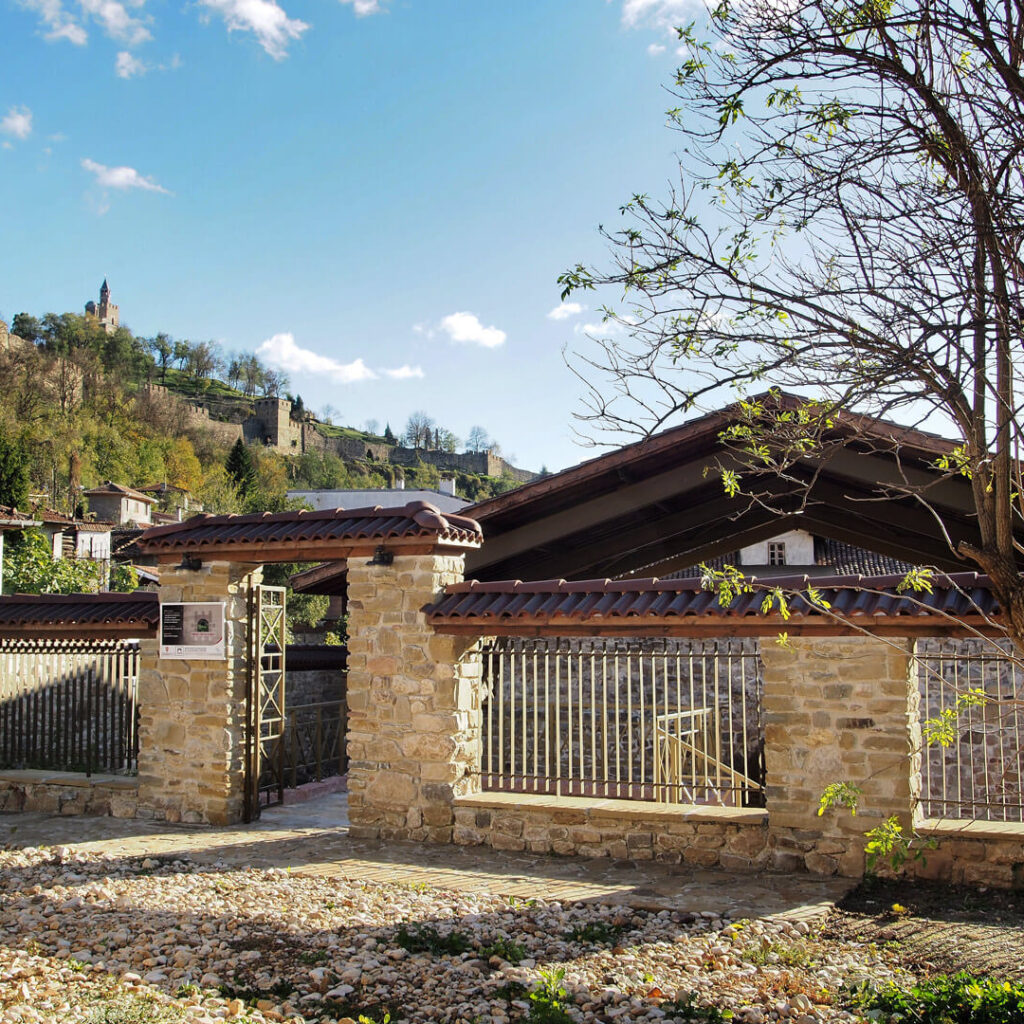
Nicopolis ad Istrum was a Roman and an Early Byzantine town. It was founded by the Roman emperor Marcus Ulpius Traianus to honor his victories over the Dacians tribes in 101 and 106. The ruins are located at the village of Nikyup, 20 km north-west of Veliko Tarnovo. The town was extended on a plateau on the left bank of the river of Yantra.
It is not by chance that Nicopolis was erected at that place. The main reason was the strategic location. The two main roads of the Danubian Roman provinces crossed there. One of them started from Odessus (Varna) and connected with the road leading to the western Roman provinces. The other road was the link between the Danubian fort Novae and the Roman provinces in Asia Minor.
Initially the town belonged to the province of Trace. In the beginning of 193 Nicopolis was included in the province of Lower Moesia. Its urban area expanded after the reforms of Emperor Diocletian (284-305). Many villas, market places, settlements were built in the surroundings.
The organization of the town shows a similarity to the towns in Trace and Asia Minor – Ephesus, Smyrna, Pergamon. The Council of archons, headed by the first archon, who had a legal power, governed the town. The rest archons took care for the finances, economics, supplying with provisions and public order. The Town council and the National Assembly were very important institutions of the local authority. A community of priests worshiped the cult to the emperor, Roman and Greek divinities: Zeus, Hera, Athena, Asclepius, Dionysus, Mithras.
People of various ethnical groups lived in Nicopolis: settlers from Asia Minor, Thracians and Roman veterans. The Greek was the official language.
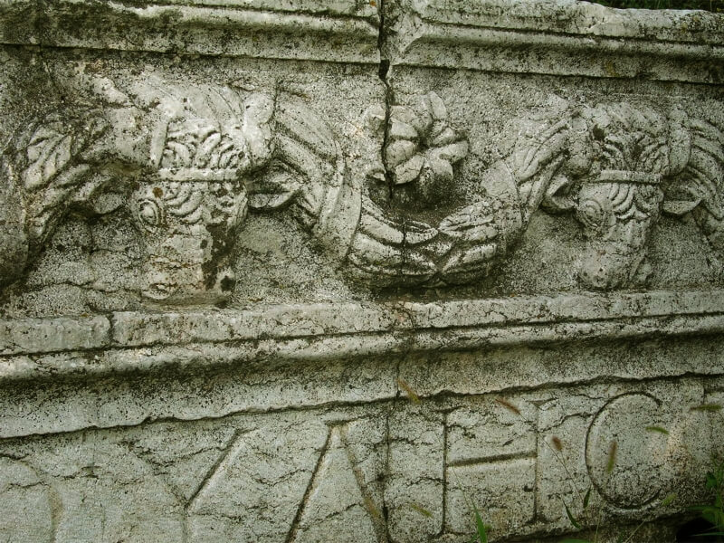
Nicopolis flourished during the reign of Antonines and Severan dynasties (the middle of the II nd – the first third of the III c.) The town minted its own coins – 900 different emissions of bronze coins bearing images of town temples, public buildings, and fortification equipments.
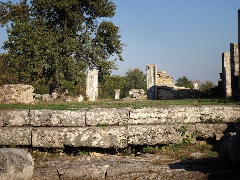
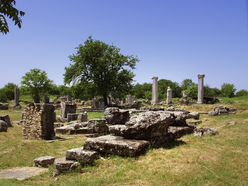
The town was planned according to the so-called “orthogonal system”: straight streets, running to the four cardinal points and decussated. The following complexes were considered during the building of the town: the Agora (the town’s square), both main streets: Kardo Maximus (running north-south) and Dekumanus Maximus (running east-west), public buildings, the market-place, residential quarters. It has been found a significant part of them during excavations.
At first Nicopolis hadn’t been fortified. Fortress walls were built after the devastating attack of kostoboki tribes in 170. There were well-protected gates at each one of the walls. The main gate was the west one facing to Rome. It was called Romana gate. The streets were covered with large lime stones and led to the town’s square. The drainage system was built under the road surface. Four streets situated at right angel formed a quarter (insula).
Nicopolis was supplied with water very well. The main aqueduct was the west one, 26 km long. It brought the water to a particular water-tank, built close to the west fortress wall. After then the town water-main system provided the water to public and private buildings, baths and toilets. Two smaller aqueducts and few wells supplied Nicopolis with water also.
The town’s square (agora) was a center of economic, cultural and religious life. The square consisted of two parts connected to each other: eastern and western. The horse statue of the emperor was erected in its center. The area (the square) was in its eastern part. It was surrounded from all sides by monumental Ionic colonnade. Some bronze and marble statues of emperors, members of their families, celebrated citizens were placed between the columns. A civic three-nave basilica was situated in the northern part of the square. It was used for making deals, jurisdiction and other public activities. Brisk trade animated the eastern and southern part of the area where numerous shops were built. The western part of the agora began with propylaea-monumental gateway, constructed of parallelepiped columns. The building of boulevterion where the town council met stood to the north of them. Close to it could be seen another public building. A particular community of priests that worshipped the cult to Cybele gathered there. There was a small theatre (Odeon) to the south of it.
An impressive public building erected eastward of the complex of the agora, according to an inscription found there, called “termoperipatos”. There were shops in it, as well as a hall where business appointments were held. A public bath could be seen in the northern end of Nicopolis.
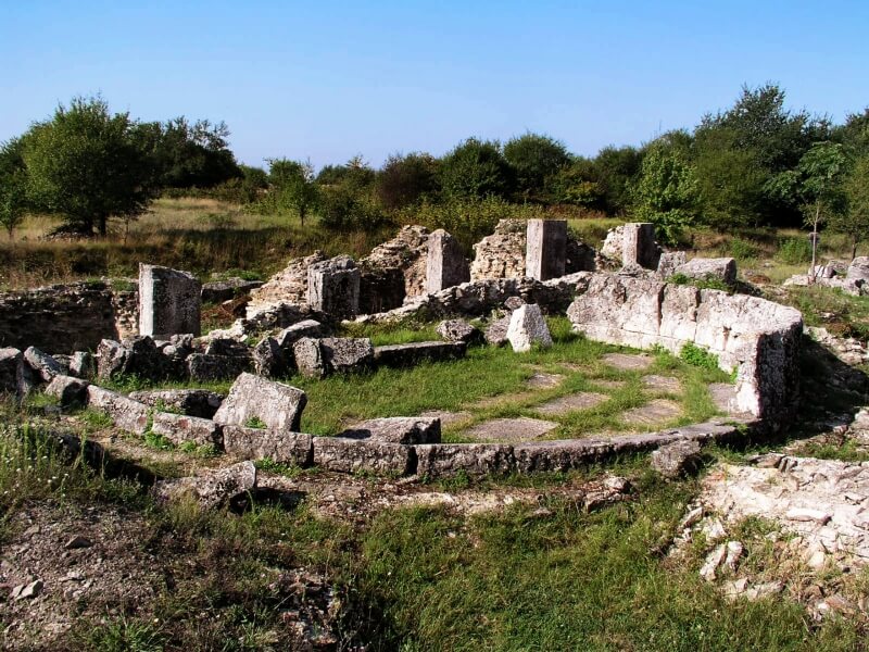
The necropolis was situated on both sides of the road, leading to Novae and around the west thoroughfare. 121 tombs of it have been preserved. The deceased persons were buried in bricked and stoned tombs and sarcophagus.
Few villas, settlements and complexes for making ceramics have been researched in the urban area of Nicopolis ad Istrum.